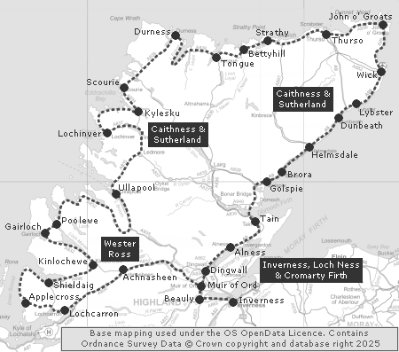
 Clickable Map of the North Coast 500 |
In recent years, problems caused by a minority of inconsiderate or irresponsible users of the North Coast 500 have increasingly come to dominate public perceptions of the route. If you intend to follow the NC500, then please ensure you do so in a way that respects those who live and work in the areas you will be driving through and staying in. We could set out a long list of "do's" and "dont's", but we'll stick to just two. Firstly, ensure you understand how to drive on single track roads: our guide is linked from here. Secondly, please be aware that, despite widespread misunderstanding, "wild camping" is NOT allowed in Scotland if you are in, on, or with a motor vehicle. If you are driving, and most users of the NC500 are, then only overnight where you have the landowner's permission.
The North Coast 500 is a 516 mile-long circular tour of the northernmost parts of mainland Scotland. The route has been described as "Scotland's answer to Route 66". We suspect the Scottish weather may be rather more changeable, but otherwise see the connection.
You could, at a real push, drive the NC500 in two long days, but that misses the point and we'd not recommend you try. At a practical level, the route contains a number of stretches of single track road, especially along the west and north coasts, and these help ensure that a more leisurely approach is likely to be more rewarding (and safer). The official website of the NC500 (linked from the "Visitor Information" section in the side column) suggests taking at least 5-7 days to cover the route and that seems sensible and practical.
The route was launched in March 2015 and in the early years the norm seemed to be to drive it in a clockwise direction, which is how we describe it below. In more recent times, the anti-clockwise option has become more popular. The argument is that this gives drivers of unfamiliar vehicles or unused to single track roads more time to settle in; and that it saves the most spectacular scenery until the second half of the trip.
Fuel is available, often on a 24-hour basis, in various locations along the route of the NC500. Given the range of most modern vehicles, we'd suggest anyone aiming to travel the NC500 fills up before leaving Inverness. That should allow most people to reach Thurso without needing to refuel, whichever way round you are going. We've seen it said that travelling the NC500 is an EV is perfectly possible, and there are a number of online resources to help you plan your trip.
We describe the journey below, linking to our features about settlements passed through en route, as well as the most significant visitor attractions. Many more visitor attractions and settlements, both on the route and close to it, can be reached using the clickable index map on this page that links through to area menus. The description below also links to our accommodation listings for the areas traversed.
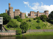
The start and finish point for the North Coast 500 is Inverness Castle, in the heart of Inverness. Accommodation in and around Inverness can be found using our Inverness, Loch Ness & Cromarty Firth area pages. You leave the city on the A862 heading west. This leads you through Beauly to Muir of Ord.
From Muir of Ord you head west on the A832 and A835, making sure you turn left off the A835 onto the A832 a little beyond Garve. This becomes a high quality modern road that leads you along Strath Bran to Achnasheen. Accommodation in the area, and for the forthcoming chunk of the NC500 as far as Ullapool, can be found using our Wester Ross area pages.
Just beyond Achnasheen, you take another left, this time following the good quality A890 south-west along Glen Carron to the end of Loch Carron and the village of Lochcarron. Turning west, you encounter single track roads for the first time as you make your way along the A896. Near the head of Loch Kishorn you have a decision to make. Here the "proper" route of the NC500 turns west and climbs what is possibly Scotland's most challenging and highest road: the Bealach na Ba, whose entrance is guarded by signs warning you it is unlikely to be open in winter and that it is inadvisable for learner drivers. The "Pass of the Cattle" is the gateway to the Applecross Peninsula, and the single track road, having taken you to the west coast at Applecross, then leads you around the coastline to Shieldaig. For things to see and do in the area, see our West Highlands Index.
Those not wishing to tackle the Bealach na Ba can avoid it, and the Applecross Peninsula as a whole, by staying on the A896, which leads north to Shieldaig. If you take this diversion you miss one of the highlights of the NC500.
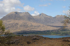
From Shieldaig you turn east and then north-east as you follow the southern shore of Upper Loch Torridon and then Glen Torridon, where it's sometimes a struggle to keep your eyes on the single track road in the face of some of the most spectacular mountain scenery in Scotland. At Kinlochewe you turn north-west on the A832 a (mainly) high quality road through superb scenery that will be your companion through Gairloch and Poolewe, then past the superb Inverewe Garden, and inland again to join the A835 south-east of Ullapool.
When we first travelled in the area in the late 1970s there was no trace of a white line anywhere on the long and winding single track road north from Ullapool to Durness, and then east along the north coast as far as Thurso. Things have changed significantly since, and many roads have been greatly improved: though there remain stretches of single track road in the far north-west and along parts of the north coast.
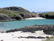
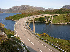
Not far north of Ullapool you enter the traditional county of Sutherland, and for much of the rest of the NC500 accommodation can be found using our Caithness & Sutherland area pages. Your route takes you north, and then west to the fishing port of Lochinver. The NC500 then follows the entertaining single track road around the coast to rejoin the main road just south of Kylesku, though for large vehicles an alternative is suggested on easier roads. The route then heads north to Durness, perhaps making time for the diversion to the fishing port at Kinlochbervie and beyond it to the magnificent beaches at Sandwood Bay and Oldshoremore. Other attractions in the area can be found using our North-Western Index.
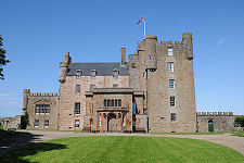
The north coast of Caithness & Sutherland has a character all of its own, and this part of your journey takes you through a string of small settlements such as Tongue and Bettyhill en route to Thurso and then to John o' Groats. Not far west of John o' Groats is the superb Castle of Mey, for many years the holiday home of the late Queen Mother and well worth a visit.
John o' Groats marks a major turning point, because from here your route trends generally south-west to your journey's end in Inverness. On the way you pass through or close to a series of towns and villages including Wick, Dunbeath, Helmsdale, Brora and Golspie. On the coast between the last two of these is the magnificent Dunrobin Castle, which should also be visited. This coast has much more to offer visitors: see our Far Northern Index for details.
A little further south the NC500 passes close to the fine old town of Dornoch, which is well worth the slight detour it entails. The same can be said for Tain, which, though arguably on the route is mainly by-passed by the road you are following, the A9. The remainder of the NC500 takes you past Alness and through Dingwall to rejoin your outward route in Muir of Ord for the final stretch back to Inverness.
|
|
|
Visitor InformationFurther Information: The official website of the North Coast 500:www.northcoast500.com Distances: The North Coast 500 is 516 miles or 830 kilometres long. |
The NC500 In Fiction
|
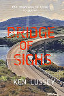 Bridge of Sighs by Ken Lussey (14 July 2026).
Main Places On Route:
Areas Passed Through: |